Just a simple notebook
Hi there! I am a recently graduated geophysicist from Argentina. I got into Data Science and Machine Learning just a few months ago, so I’m certainly an inexperienced little tiny deep learning practitioner as you may well guess.
Here are some questions you may ask yourselves…
What is this challenge?
This challenge tries to overcome something that has troubled the Oil&Gas industry for so many years: how can I interpret such huge amount of information in so little time?
Seismic facies are one of the abstractions that are regularly used to compress the amount of information. We define that certain patterns in the seismic image are defined by the response of a certain layer, this layer, when grouped with several other layers with the same characteristics, tend to generate a response that stands out from other patterns in the seismic image.
This common response helps grouping these layers that behave similarly, and thus helping reducing the amount of information on image.
But how do we group all these patterns together?! Well, Deep Learning to the rescue!
Let’s dive in:
What did you do?
The last few hours I’ve tried to put together a simple notebook that goes from showing some simple seismic attributes, to implementing a deep learning model. I hope that if you are starting just like me you’ll find it useful. And if you are an already experienced machine learning practitioner, you might find some insights on how to improve your results!
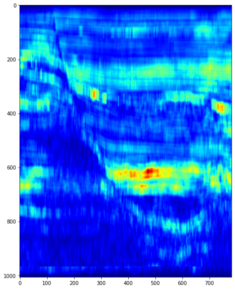
A couple of examples from the notebook:
TECVA seismic attribute

RMS seismic attribute
How did you do it?
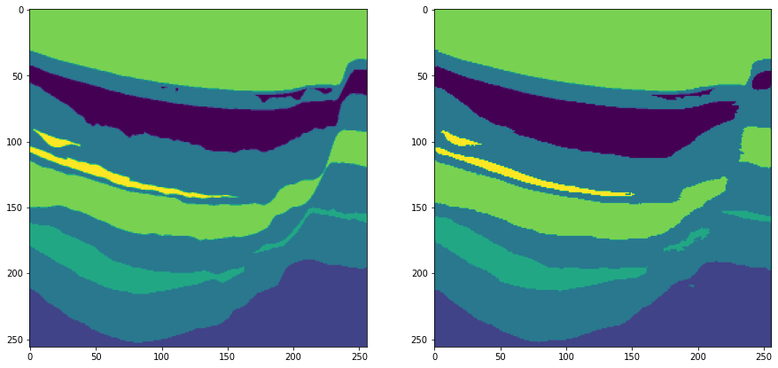
I started by using my seismic attributes knowledge, then I tried to think of a way of implementing different kinds of information, and finally, I used the keras-image-segmentation package that you can find here: https://github.com/divamgupta/image-segmentation-keras to produce a model, train it, and generate the final predictions.
Sample image of the results of training the net (label set / trained set):
Well, but I could have done that on my own!..
Well, of course you could! But beware that I also try to give an insight on some facts over using this seismic dataset and how you may improve your results by taking this into account. Maybe it will help you!
I don’t really know about these seismic facies and stuff…
Well, maybe you just like to watch at some random guys’ notebook and you’ll probably like those nice images!
LINK TO THE NOTEBOOK: https://colab.research.google.com/drive/1935VS3tMKoJ1FbgR1AOkoAC2z0IO9HWr?usp=sharing
You can also get in touch via Linkedin (link to the post with this notebook)!:
Hope you guys find it useful, funny and maybe consider giving it a thumbs up!
See you around!