EDA on variation by geographic axis
Here’s my EDA notebook on how the seismic data varies by geographic axis, along with some ideas for training.
A peek some of the stuff in the notebook
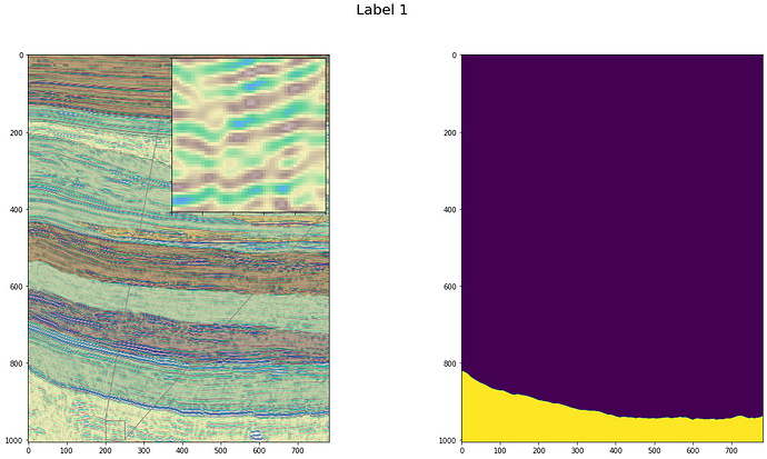
How the patterns look per label:
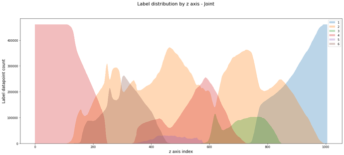
How the facies vary by z-axis
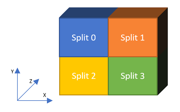
Splitting the data for training based on the EDA results
Do share your feedback. 


